The Tufa Field Geology and Hydrology
The City of Bath lies in a valley surrounded by seven hills. These are largely limestone, the hill of Combe Down being quarried extensively to provide stone for the Georgian buildings which now confer World Heritage status on the City. Other smaller quarry sites are evident on the hill of Odd Down. Quarried stone has been used at least since Roman times for building and road construction.
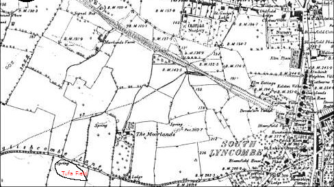
This ancient spring appears on maps of the area from the c.19th , being the main watercourse for the Moorfields Farm that existed to the North.
Geological Strata
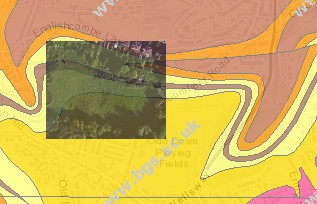
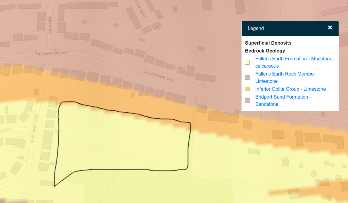
Our site contains two major deposits, split along it’s length. The southern half of the site extending about halfway to the North is a layer of Fuller’s Earth mudstone while the northern half is Fuller’s Earth Rock Member. Fuller’s Earth is a well known feature of the Bath area, being commercially mined until the late 1970’s. It is highly water-retentive and forms an effective aquifer making for complex hydro-geology at the site.

It is probable that this layer ‘powers’ the springs lower down the hill, at Moorlands Schools, the Moorlands Park, the Oval green space and at various other points along the boundary layer with the more impermeable limestone material in the adjacent slope.
Geological Survey Results
The BGS Survey of 1984 for Bath City council clearly identifies the mudslide areas on the southern slopes.
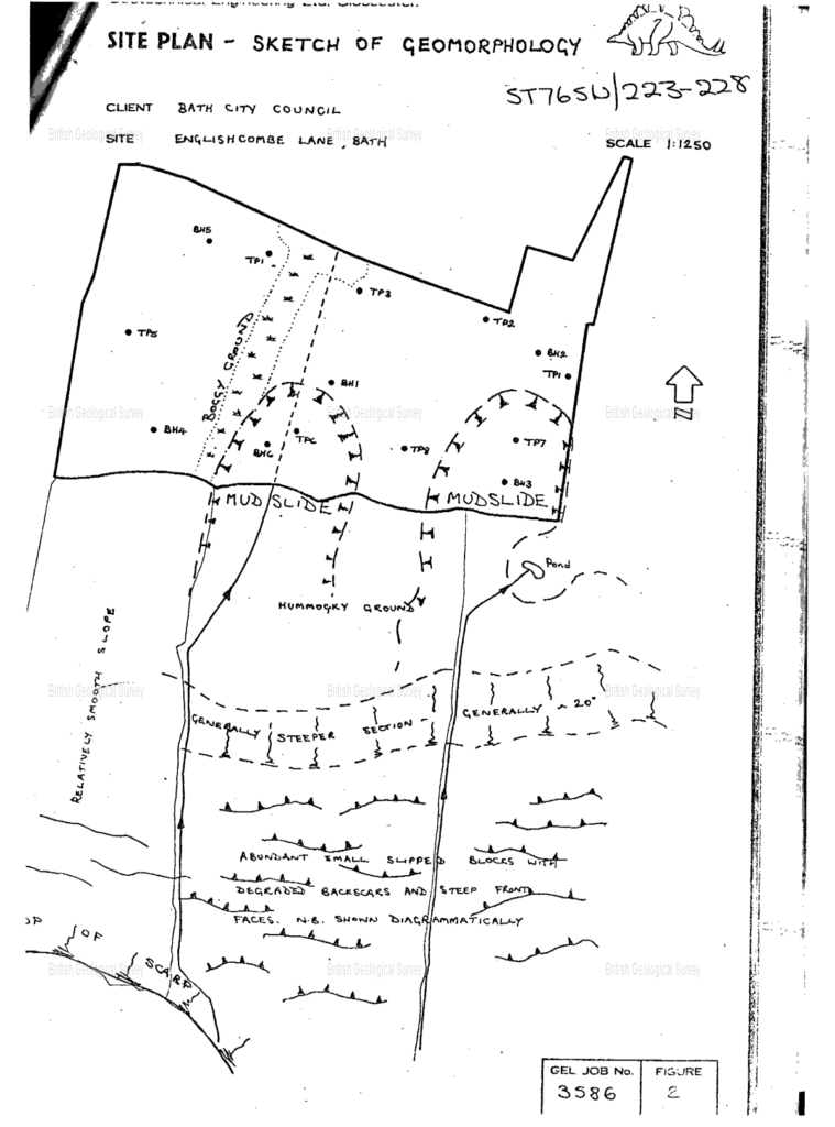
The Borehole data confirms the unstable nature of the upper layers to the borehole depth of 6 m.
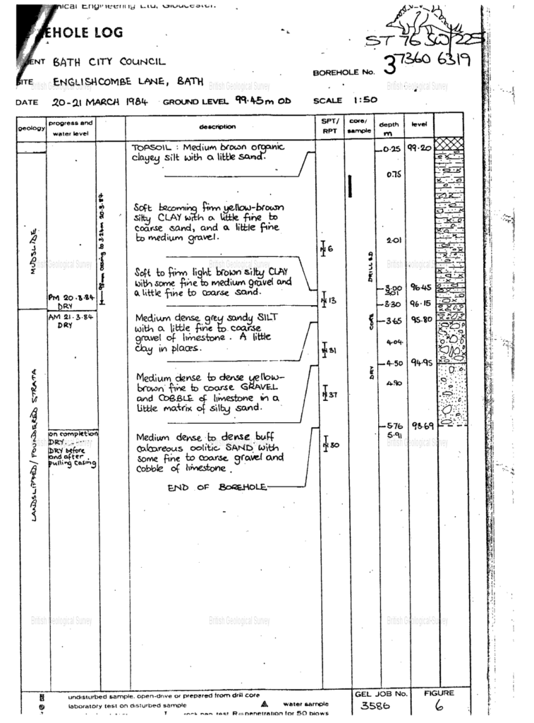
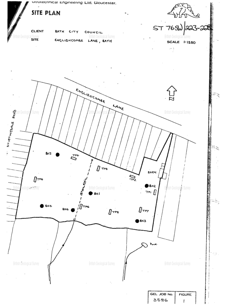
The Borehole is located at BH3 on this map.
Borehole 2 shows the more stable conditions on which the existing housing is built. Borehole 5 shows more unstable ground.
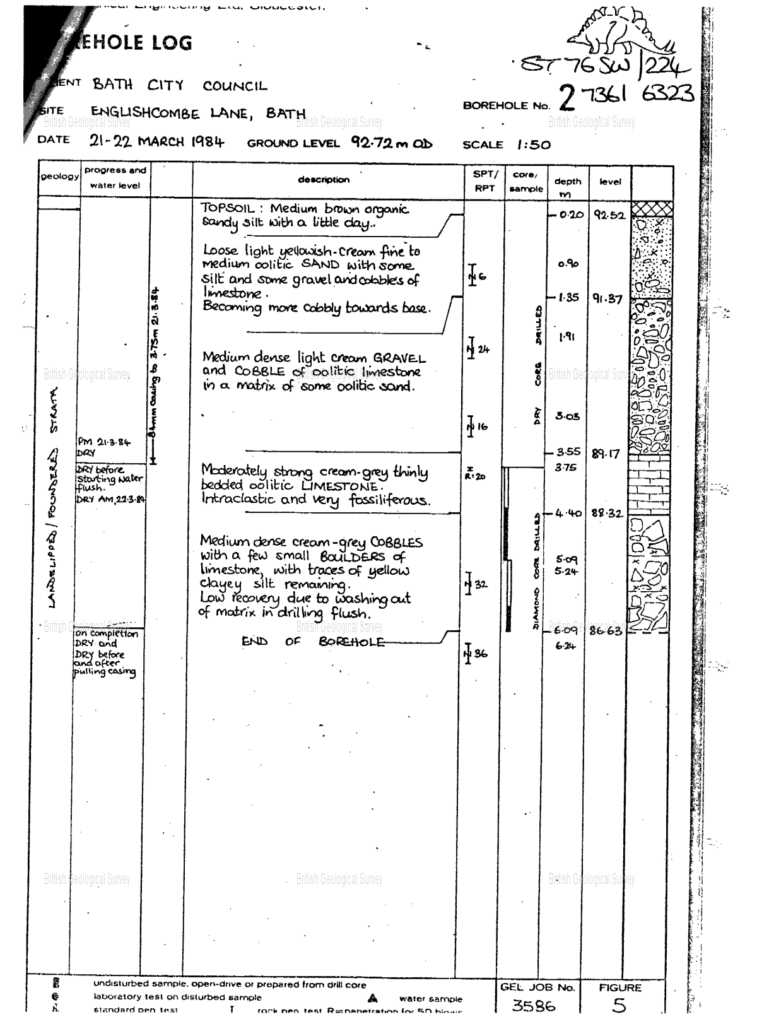
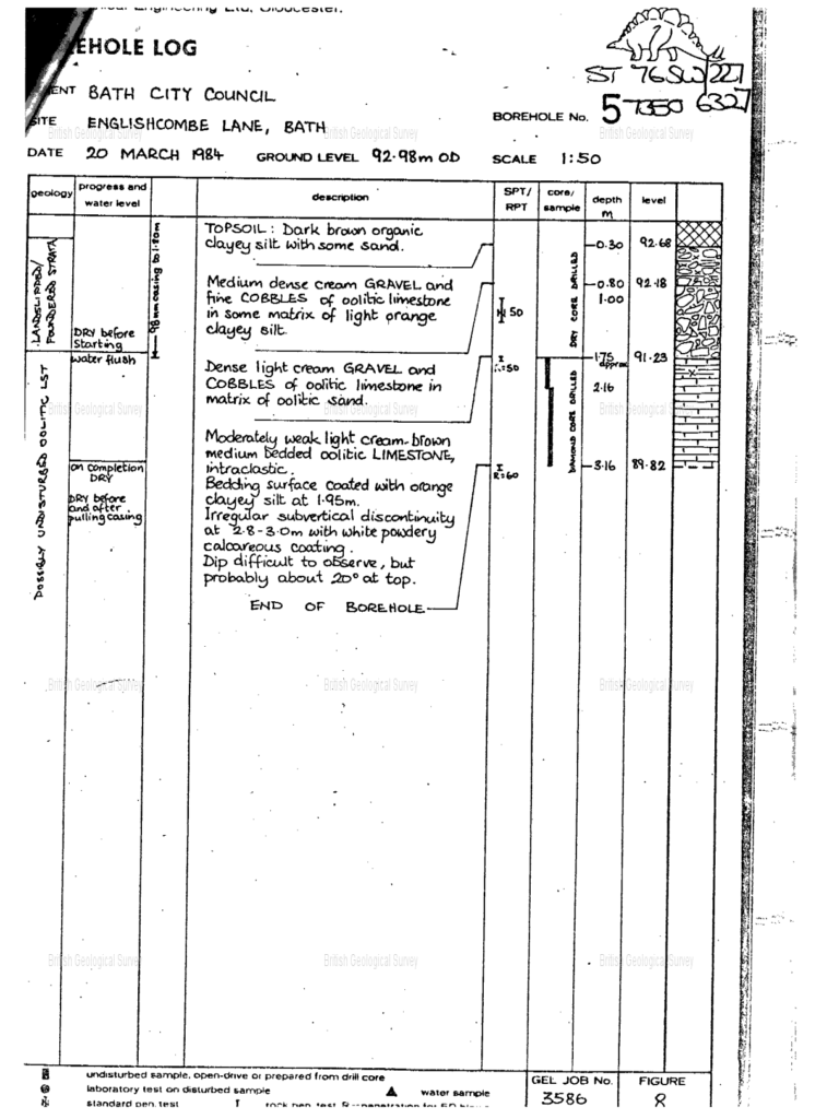
The borehole information confirms the strata boundary shown on the BGS map, i.e. to the north is stable ground, to the south of the boundary edge is unstable.
This report contributed to the abandonment of building plans in the 1980’s.
Flood Risk
The ability to effectively store large amounts of water provides a significant buffer to mitigate flooding in the main Avon valley.
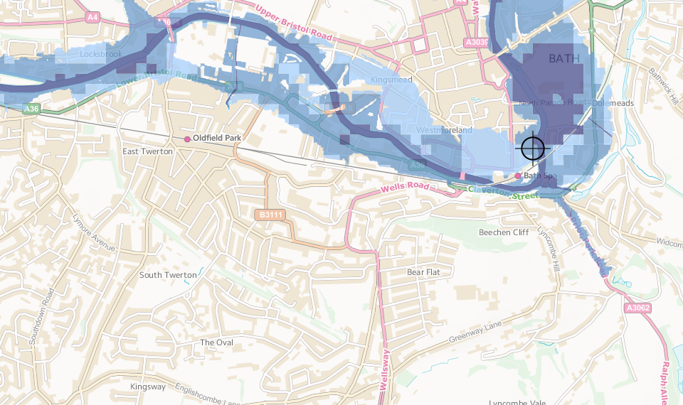
Surface water flooding is a particular concern as more green areas are paved over. Green fields, especially uncultivated ones, provide considerable surface water buffering, by absorbing sudden downpours.
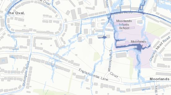
The potential for increased flood risk to Moorlands Schools when the Tufa Field is developed is highlighted by this map, which shows the current risk areas (to persons, services and properties)..
Land Movement and Slippage
For existing residents in the surrounding area, there is always concern for land movement. The sub soil structure to a significant depth contains large quantities of yellow clay ( mudstone). This is subject to shrinkage and expansion, according to water content, and , in extreme circumstances, slippage. As the clay dries in summer, shrinkage takes place, leading to subsidence. In winter, when runoff water from Odd Down is absorbed by the mudstone layer, the clay expands, causing ground heave.
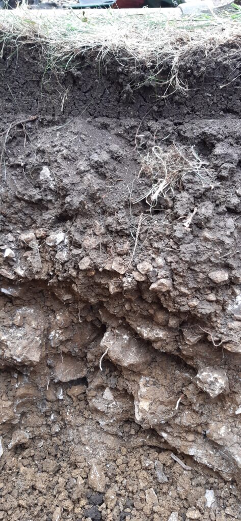
Examination of the section from an adjacent garden excavation reveals the nature of the mudstone. In general, consolidated stone pieces are in the size range 2-10cm. Some layers are recognisably stratified, 1 to3 cm in thickness, with silt between. Constant drying and wetting of the silica layers has caused the stone layers to fracture, so silt has also accumulated in the fracture planes.
The silt/clay layers are notable for their changing viscosity with water content. In very dry times, the clay shrinks markedly, reducing support for the stone layers. As water content increases, the clay expands and becomes very viscous, adding stability to the layers. This is the ‘normal’ state of the mudstone. But as water content increases further, the viscosity drops rapidly and the clay acts as a lubricant for the stone strata, allowing movement to take place. As the hillside slope increases, these layers become mobile, leading to the observed mud slumps in the field.
Occasionally there are pockets of just clay, some exceeding 50cm depth and 50cm radius. These have no structural strength and need to be eliminated during groundworks.
Clearly water content and slope stability are very closely intertwined, with artificial changes to the water content having the ability to impact ground stability both through diminished and increased water content.
Building on such land, especially where there are discontinuous layers, has to be designed very carefully, and may require stabilising raft foundations or piling to prevent land movement damage to buildings over time. While these measures are possible, the cost of doing so is very high.
Carrying out these extensive groundworks is also difficult. Heavy machinery may not be easily deployed in a sensitive site and there remains a great danger that the works cannot be practically undertaken without great damage to the site.
Foundered Strata
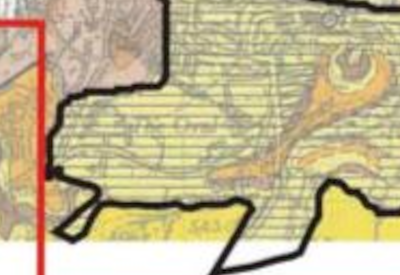
The term ‘Foundered Strata’ is used to describe areas where extensive landsliding and cambering have occurred, but beneath which the solid geology could not be determined by the mapping geologist. More recently, the term foundered strata has been use to mean “collapsed strata… areas subject to natural or non-induced subsidence where no new deposits are produced, for example areas of collapse resulting from evaporate dissolution or extraction” .
The map shows such an area bounding the Tufa Field , i.e. liable to slippage.
Land slippages around Bath are common, and well studied, Hobbs and Jenkins identified 23 such slips in this 2008 study, including one in Bloomfield Road attributed to water from the Great Oolite cap on Odd Down.
External links :
Information from the British Geological Survey
Factors Controlling the Growth of Tufa
https://www.sciencedirect.com/topics/earth-and-planetary-sciences/tufa
Review of tufa deposition and palaeohydrological conditions in the White Peak
https://bathgeolsoc.org.uk/journal/articles/1982/1982_Tufa.html


 Total views : 155635