Weather and Rainfall at the Tufa Field
Rainfall is very important at the Tufa Field. It feeds the streams, and in extremes, contributes to land instability, affects run-off into Englishcombe Lane and Moorfields, and contributes to down-slope springs that cause local flooding.
The Wunderground network is a collection of largely amateur weather stations that document weather, including rainfall, at a very local level.
This is important since it can track long-term trends in weather, and document short-term extreme weather events.
The local station is https://www.wunderground.com/dashboard/pws/IBATH46 and there you can see the historical weather data (as well as get a local forecast)
Here is an example for August 2023, showing the total rainfall as 71.86mm.
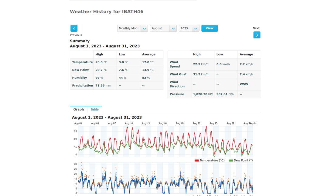
These precise local measurements show the actual rainfall on the Tufa Field and immediate surrounds, and paints an interesting picture.
Met office historical climate data shows that the area is inevitably getting wetter.
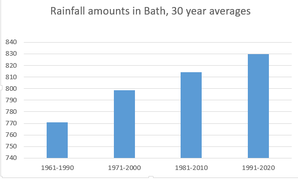
Currently, the long term average annual rainfall is about 830mm
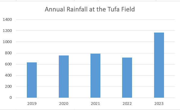
If we now consider the last 5 years actual rainfall on the Tufa Field, we see that there have been some dry years, leading up to 2023, where the total rainfall is much higher, but the average over that period, at 812mm, is in line with the long term climate trend.
From this we should conclude that high density rainfall years will become more common, even if there are dry years in between.
Management of such rainfall patterns is a complex matter, requiring both worst case scenarios now and for the lifetime of any development.
We await the SUDS plans for this development.


 Total views : 68010